'Needed to do some climbs, and, as — true — mountains are about as common as independent thinkers on this sunny, tropical-island-paradise-with-the-death-penalty, I headed across the Causeway:

Gunung Soga. With an elevation of 820 feet (250 m), technically, it is not a mountain but a hill (hence its alternate name, Soga Hill).

For more than an hour, I rode around on country roads, following confusing signs, written in a language I'm hardly proficient in (Bahasa Melayu), but never quite getting to the "mountain."

After about an hour, I ran into this sign.

After climbing up the hilly estate of Taman Perdana, I discovered, to my chagrin, that the lower half of of Gunung Soga's west face has been razed and terraced for a new housing estate. What remains of the road to the summit has been replaced by a series of steps :-(

If Mountain 1 won't do, switch to Mountain 2. A view from Jalan Minyak Beku. The transmission tower left of the center of picture denotes the summit of Gunung Banang.

Immediately after Restoran Steam Boat Garden lies the access road to Gunung Banang.

View of the 1402 ft (427 m) summit. Temperature is a not too pleasant 91° F (32.7° C).

Current elevation: 40 ft (12 m). When I last climbed this in 1995 (yes, I'm one old fogey) with UmmaGumma, no one resided at the base of this road. Though dwellings exist today, they only extend to the first 100 meters of the road. Someone measured the road's length to the summit, beginning from the white line.
View Larger Map
Map of the local area.

After 12 minutes of climbing: the first rest spot. It is also the first flat section. Elevation: 675 ft (205.8 m). Distance (from the base of mountain): 0.72 mile (1.15 km).

The hammocks look inviting. It is also cooler at 87° F (30.6° C).

At the 1 mile (1.6 km) mark, the elevation is 785 ft (239 m).
'Brought my iPod Nano along, but didn't need it — I already had a song in my head. As I climbed, it went on repeat:
I hear you're driving
someone else's car now...
She said you came and
took your stuff away.
All the poetry and the trunk
you kept your life in —
I knew that it would
come to that someday...
Like a sad hallucination,
when I opened up my eyes,
the train had passed the station,
and you were trapped inside...
And I never wonder where you went
I only wonder why...
Oh Caroline
Oh, oh, Caroline
Oh, Caroline
Oh, oh, oh, oh, Caroline

Second rest spot. The benches were not here 13 years ago. Distance from the base of mountain: 1.1 mile (1.75 km). Elevation: 865 ft (263.7 m).

Unlike the other rest spots, this one is not on a flat section (they are rare on this road anyway). Temperature: 82° F (27.8° C).

Onward.

Third rest spot. Elevation 1040 ft (317 m).

A short dip provides brief respite.
Well, I hear you're using someone else's number;
She said she saw you in the store today.
It don't matter whose address
you're listed under,
I only know they'll never make you stay
Like a memory in motion,
you were only passing through...
That is all you've ever known of life,
That's all you'll ever do.
There's a dream I have where I sail away;
Looking back, I wave at you,
and I wave goodbye...
Oh Caroline
Oh, oh, Caroline
Oh, Caroline
Oh, oh, oh, oh, Caroline

I just had to take this (distance measured from the base of the mountain, of course) :-D Elevation: 1115 ft (400 m).

Fourth and final rest spot. A weather system is moving in, compromising the accuracy of the barometer-based altimeter. Distance from the base of mountain: 1.5 miles (2.45 km). Temperature: 80° F (26.7° C).

The rest of the pictures were taken going downhill as dismounting would render it difficult to get on the bike again.
The gradient gets significantly steeper after this sign.

The last 50 meters can best be described as a religious experience :-P

Elevation 1402 ft (427 m). Distance from the base of mountain: 1.72 miles (2.75 km). Transmission tower. This is the only picture I managed to take of the summit (and I had to do it on the sly, pretending to take a shot of the downhill). A fenced military outpost lies here. The Malaysian Amateur Radio Transmitters' Society also maintains a repeater here.

Great, big raindrops fall as I began my descent.
In another life I see you
As an angel flying high,
And the hands of time will free you —
You will cast your chains aside —
And the dawn will come and kiss away
Every tear thats ever fallen
From your eyes...
Behind those eyes,
I wonder
Oh, Caroline... oh, oh, oh...
Oh, oh... Caroline...
Sometimes I wonder...
Oh... Caroline
Sometimes I,
Sometimes I wonder...
Epilogue:
Total distance: cyclo-computer 45.8 miles (73.3 km)
Total elevation climbed: Altimeter 3280 ft (1000 m)
Temperature range: 77° F to 94° F (25° C to 34.4° C)
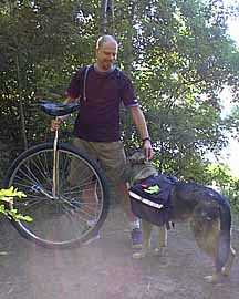
Ride conducted solo.