An easy ride around the general area of Canning River and Swan River today. Here's a large Pelican (I love Pelicans) by Riverton Bridge.
How to get around.
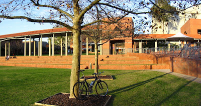
Along the way I decided to visit my lovable li'l sis' alma mater (3 of my cousins also hail from this university).


Grub at the rather pricey Kirribilli Cafe. AUD$5.50 for a sandwich is reasonable, but AUD$4 for a regular coffee at a university? (Yes, yes, I know beer can be had for cheaper at the Tavern, Sis, but I didn't plan on getting smashed while riding.) The temperature at 66 F (18.9 C) made for a pleasant lunch though.
I had a lark going around asking the staff and faculty if anyone remembers a ditzy, clueless, tall Asian chick who used to study there, and is a remarkably bad driver, rear-ending others with a frequency exceeded only by bumper cars in amusement parks. (You are welcome, Sis!) Siblings are such fun, ya? :-P
Returning to the banks of the Swan River.
The pedestrian overhead bridges are very well designed in Perth. The grade is gentle; there are no abrupt switchbacks or speed humps, and the lanes are wide enough for pedestrians and cyclists to pass without jousting each other.
The apex of the bridge.
Heading back down to the banks of the Swan River.
Crossing the Narrows Bridge into Perth. Kwinana Freeway lies to the immediate right.
After climbing up Kings Park from the University of Western Australia (UWA). A fair number of UWA co-eds running up the unlit roads up the hill kept me company :-D
Ivy taking in the sight.
Boo!

A rather poor panorama of the Swan River from the top of Kings Park. The UltraPod II is wonderful but lacks a built-in spirit level.
48 F (8.9 C): perfect weather for cycling.

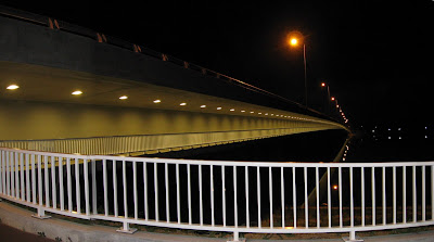
The bicycle lane at Mount Henry Bridge runs beneath the road — all 660 meters (0.4125 mile) of it.
Anyone ancient enough to remember the cheesy, looped, launch sequences on Battlestar Galactica?
Tripods. The small, black UltraPod II is always with me on rides. The larger, silver Hakuba comes along for road rides. The pistol-grip, heavy-duty, Slik, large enough to slug kangaroos and wombats into orbit, is only brought along when I'm driving. Weight-weenie photo-buffs might want to check out the string tripod.
Epilogue:
Total distance: cyclo-computer 38.9 miles (62.24 km) / GPS dead
Total elevation climbed: Altimeter 1240 ft (378 m)
Temperature range: 48 F to 66 F (8.9 C to 18.9 C)
Ride conducted solo.

No comments:
Post a Comment