In his column, "Happy Trails," on the November 2005 issue of
Mountain Bike Action, Richard J. Cunningham mused:
Wild Western mythology cultivates the notion that happiness waits for us somewhere over the near horizon. Repeatedly, for reasons that can never be truly explained, we drive past our own mountains and wild places on the way to some distant spot on the map where we believe we will be rejuvenated by natural forces that are specific to that one place. Why are we ignorant of, or unwilling to seek, the possibility that such magic could exist in our own backyard?
Universality can be described as the unique quality of a place or thing that rings within all of us, regardless of culture. Swish through the redwood forests near Santa Cruz, traverse the Alpine passes in the Engadine region of Switzerland, or thread the narrows of a red rock canyon in Utah, and you will agree that nature does not distribute her blessings equally among us. The magnitude of these postcard places guarantees that a visitor will be moved by the experience. It slaps us in the face.
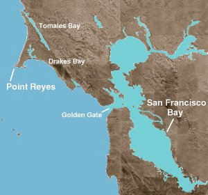
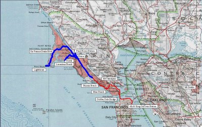
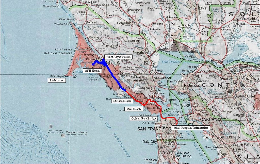
Decided to ride from San Francisco to Point Reyes Lighthouse. The lighthouse lies on the southwestern extremity of the
Point Reyes National Seashore reserve. The Point Reyes Peninsular is a unique piece of land far, far away from its origin. It has been moving for millions of years on the Pacific plate. This is why it is geologically so different from the mainland. Currently, the entire triangular piece of land is moving northwestwards at a rate of 3 to 4 centimeters a year. In the 1906 earthquake, it
moved 20 feet.
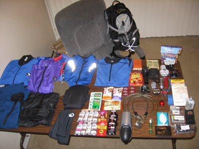
Pack contents for the trip. Clothing: (top row, left to right)
Bellwether thermal fleece jersey, Bellwether ultra-light windbreaker (made of the same material as parachute canopies),
Specialized windbreaker,
Sugoi windbreaking vest, Sugoi jersey (for next day's riding); (lower row)
Mountain Hardware Rain jacket and ultra-light pants, briefs (for lounging around and sleeping), Andiamo! cycling undershorts (for next day's riding),
Pearl Izumi arm warmers.
Food: (top right corner) instant oatmeal for breakfast, freeze-dried pasta primavera for dinner; (center)
GU20 Electrolyte replacement salts (x2),
Cliff Bars (x2),
Odwalla Bar (x1), Espresso Candy (x5),
GU Energy Gels (x8),
Cliff Shot Gels (x3),
Crank Electrolyte Gels (x2). Not pictured: 3 liters of
Cytomax in Camelbak bladder.
Emergency thermal blanket and body warmer, lightweight tripod, digital camera, spare batteries, primary LED headlight, back-up
Gerber Tracer LED light, secondary LED light, Swiss Army knife,
Garmin Forerunner 201 GPS, Cyclo-computer / altimeter, compass / whistle / analog thermometer, secondary rear LED light, aspirin and tylenol case (painkillers), maps and CalTrain schedule, cable and lock,
Cage Rocket, toothbrush, cycling wallet (ID, credit card, calling card, medical insurance, money), tissue, spare tire tube, patch kit, tire levers,
Topeak Alien multi-tool, chain lubricant, spare chain pins, spare chain links.
Everything other than the
Cage Rocket goes into the
Camelbak HAWG.
Nov 1:
Boarded the 6:27 AM northbound
CalTrain from Santa Clara.
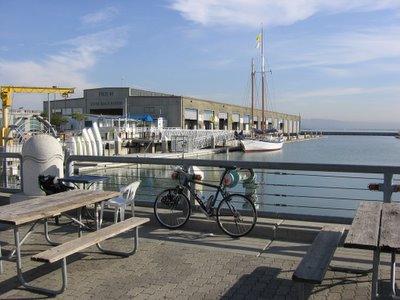
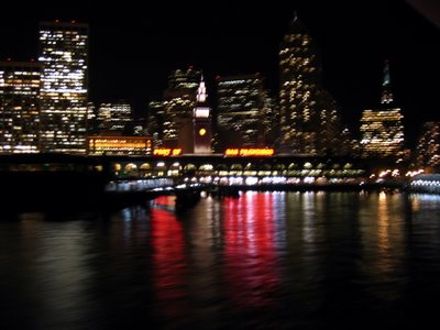
Reached San Francisco at 7:48 AM and rode 1/2 a mile down to Pier 40 to a hearty breakfast of spicy polish sausage, 3 scrambled eggs with cheese, hash browns, 4 pieces of wheat toast, and a mug of coffee. Sorry, no pictures of the meal as the sea gulls and pigeons will make off with the food as soon as you step away (I tried and lost some of my scrambled eggs that way). There is an interesting
story about
The Bike Hut, a bicycle rental kiosk located at this pier. On weekends, one can observe tourists with its rental bikes struggling up to the Golden Gate Bridge. Continued on my journey at 9 AM.
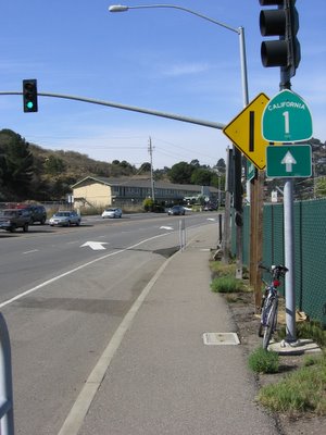
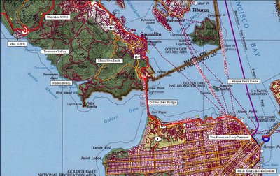
13.72 miles (~22 km): crossed the Golden Gate Bridge, passed through
Sausalito and leaving
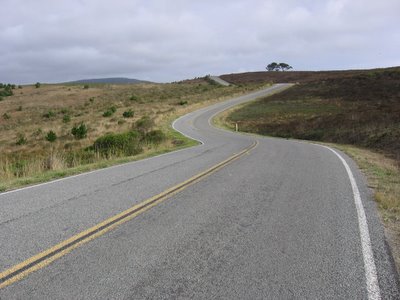
Marin City. Taking Shoreline Highway 1 northeast from here.
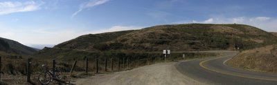
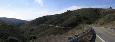
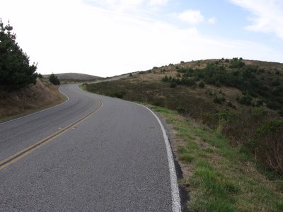
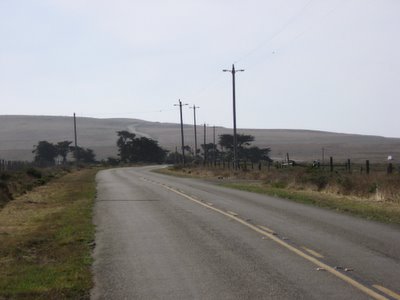
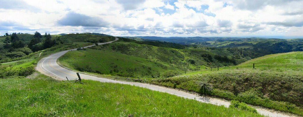
Still on Shoreline Highway 1: elevation 611 ft. The road on the right (Panoramic Highway) is a tougher way to Stinson Beach as it climbs to
Pantoll Ranger Station (elevation 1500 ft) on the flanks of
Mount Tamalpais (VR) before descending.
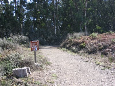
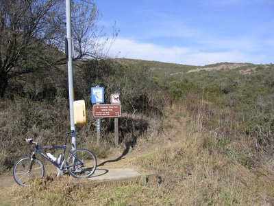
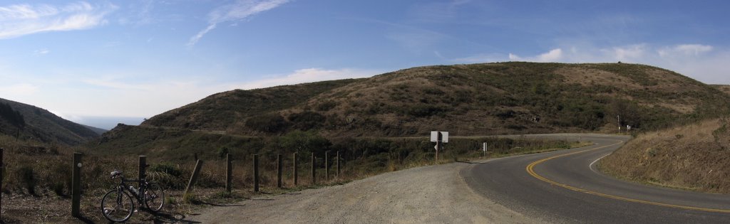
Beside Shoreline Highway 1, Miwok fire road trailhead leading southwards to
Tennessee Valley.
Shoreline Highway 1 heading west towards the ocean. The portion of Miwok trail (fire road) that's southbound is located on the left; Miwok singletrack begins on the right, behind the yellow call box; it leads to a steep, rutted fire road on top of
Diaz Ridge (overlooking and paralleling the road). Temperature is a pleasant 68 F (20 C).
Crossing Highway 1, Miwok trail becomes a singletrack that switchbacks 1/2 a mile to reach Diaz Ridge Fire Road.
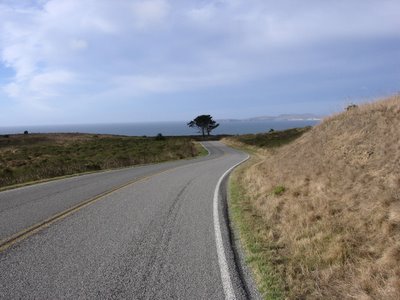
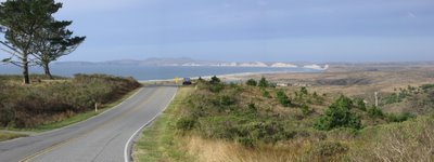
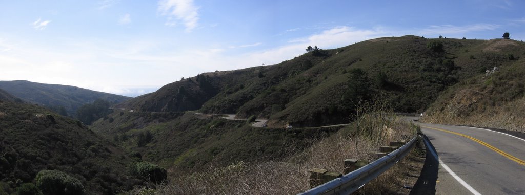
Losing 601 feet of elevation along Highway 1 eastwards to
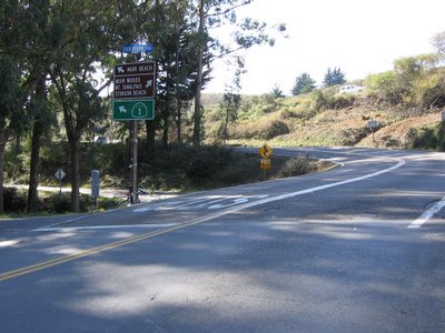
Muir Beach (map). This portion of the road is in good repair and free of gravel, allowing one to really fly round those turns.
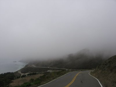
After reaching
Muir Beach, Shoreline Highway 1 turns north, climbs 500 feet and loses it again in a series of rollers (ups and downs) ranging from 200 feet to 380 feet to 481 feet. Occasionally, fog blows in from the Pacific Ocean, causing the temperature to dip and wetting things. Technical wear is worth every cent here as it is a nuisance to be frequently stopping to don or remove your jacket. Skipped visiting
Muir Beach Overlook this round as I wanted to make good time.
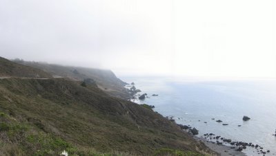
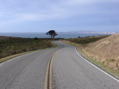
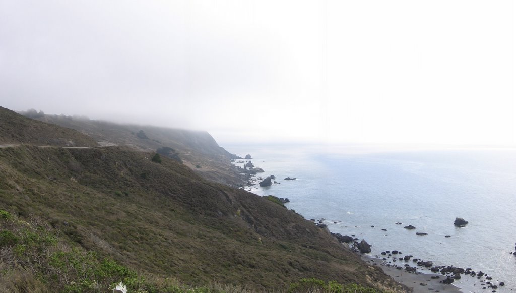
Looking back from where I came. This portion of Shoreline Highway 1 is essentially carved on the base of Mount Tamapais' flanks. A
view of the road from a higher elevation when I was riding up Coastal Trail on a
previous trip.
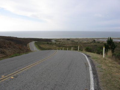
Rocky Point, elevation 380 feet, overlooking
Stinson Beach (1).
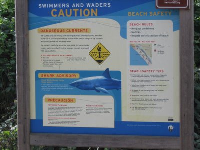
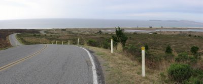
Warning at
Stinson Beach (2).
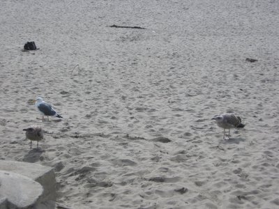
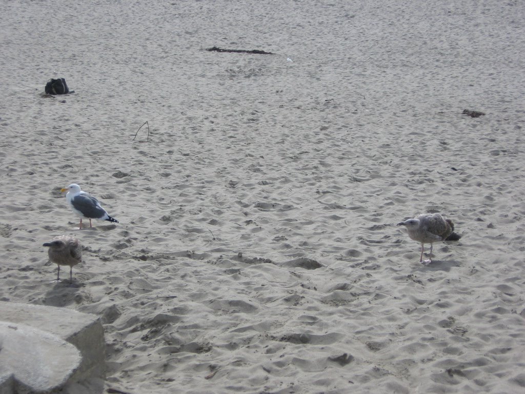
I think the bird on the right is a chick. It kept pestering other birds for food with a kind of chirping that is peculiar to chicks. Its feathers look kind of downy too. It is almost the same size as the adults (left) though.
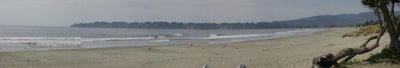
27 miles (43.2 km) later:
Stinson Beach (map). I was here a long, long time ago. This is the first time I am here on a bicycle though.
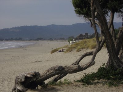
Nice to know that this venerable tree is still here.

Leaving Stinson Beach behind. 13 miles to Olema. I managed a brisk pace averaging 17.3 mph (27.7 km/h) for about 42 minutes. It felt good.
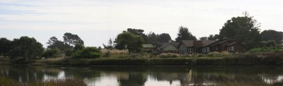
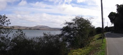
A beautiful house by
Bolinas Lagoon. If not for its proximity to Shoreline Highway 1, it would be a great place to grow old in. The town of
Bolinas is interesting: the folks guard their seclusion with almost fanatical zeal. There is no sign that indicates the turn from Shoreline Highway 1 to Bolinas. Every time
CalTrans puts one up, within a few hours it will mysteriously disappear. Sounds like "Skin Man" needs to send in Mulder and Scully.
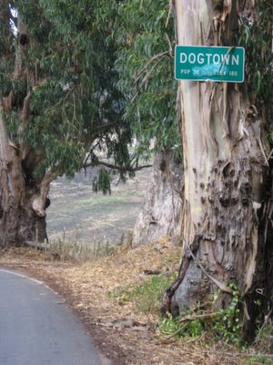
Five miles on: Dogtown. I never knew such a place existed. Population 30. Do they count the dogs too? Woof! Woof! Total elevation climbed so far: 5740 feet.
This portion of Shoreline Highway 1 is 1200 feet below — and is parallel to —
Bolinas Ridge Fire Road, an 11.25 mile (22.5 mile, 2200 ft of climbing, out-and-back) trail that I had my eye on for some time. It is ranked number 28 on
Mountain Biking: Northern California's Best 100 Trails. Maybe I might be able to do it before the winter deluge arrives.
As I passed by a country house at
Five Brooks, a little girl of no more than 5 years of age, sitting on the trunk of a car while her mother unloaded the groceries, spotted me on my bike. She gave me this grimace of determination and punched the air a few times in a gesture of encouragement. Know what it feels like to chuckle on wheels? It is magic. Just pure magic.
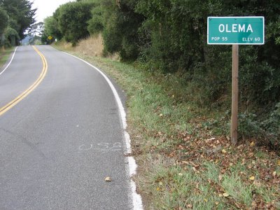
41 miles (65.6 km):
Olema (map) town limits.
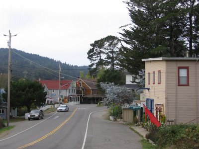
Downtown
Olema (1). The road on the right is southeastbound Sir Francis Drake Boulevard, it goes over a series of hills to
Fairfax, San Anselmo, San Rafael, and Larkspur. This portion of the road will bear special significance to me later.
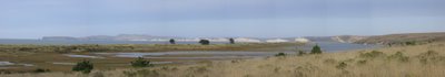
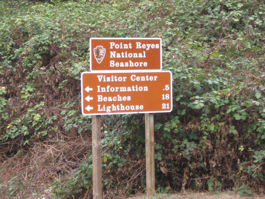
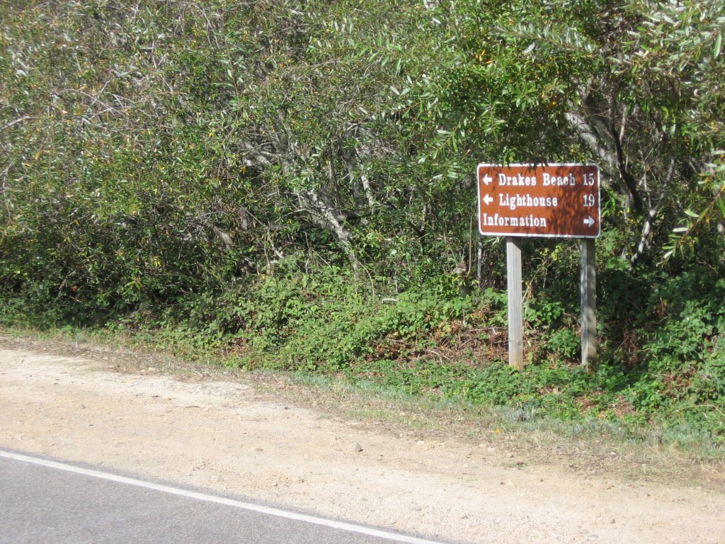
 Point Reyes National Seashore
. The lighthouse is my intended destination.
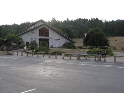
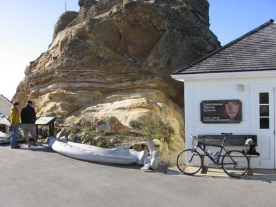
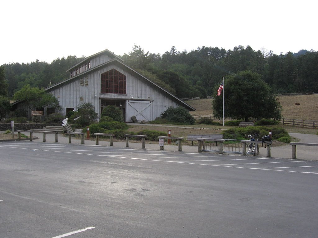
Visitor Information Center, elevation 100 ft.
Found out from the ranger that it was unrealistic to attempt to cycle to the lighthouse and back (21 miles / 33.6 km each way, plus significant climbing) in the 2.5 hours before sunset, so I decided to have a late lunch at
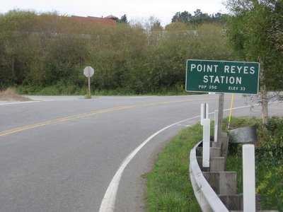
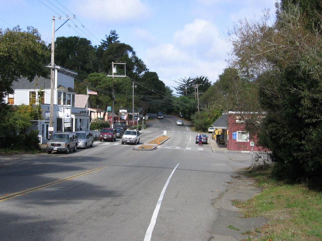
Point Reyes Station (1), 2.5 miles away.
 Point Reyes Station (map)
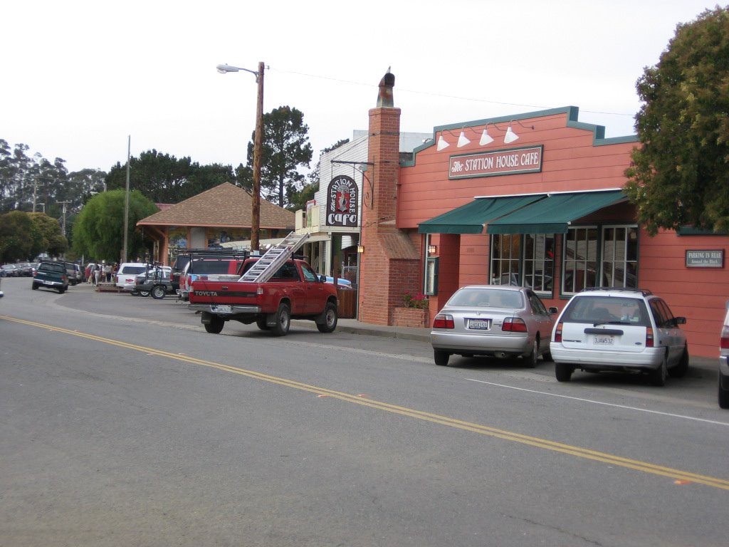
 is an interesting town: an eclectic mix of cowboy town, surfer scene, and yuppie money, all coexisting without any apparent boundaries. You will see a surf shop next to an animal feed store, or a beat up, rusty hulk of a 1970s Ford truck next to a 2006 Cayenne Turbo.

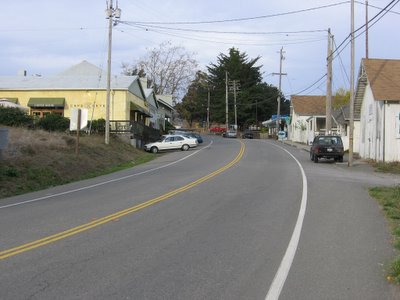
One would ask, "What would an art gallery (right) be doing in a town with a population of 350?" One word: yuppies. Anyways, I tried to take this picture as traffic stopped for equestrians but couldn't get my camera out fast enough. You can catch the tail of the last horse near the base of the lamp post if you look carefully. Total climbing so far: 6230 feet (1899 meters).

More of downtown Point Reyes Station. The Station House Cafe is supposed to serve really good food, but I don't think I will be too comfortable dining there in my jersey and tights, all grimy with the road and sweat. I was, though, sorely tempted to spend the night here as there is a cozy bed and breakfast just 1 mile away:
Knob Hill.

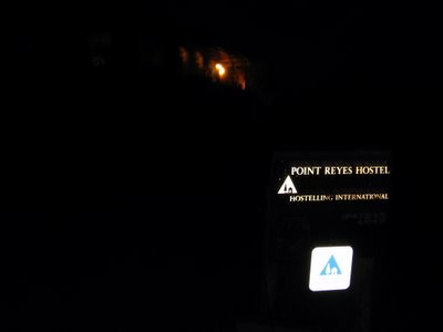
Instead, I cycled 10 miles (16 km) to
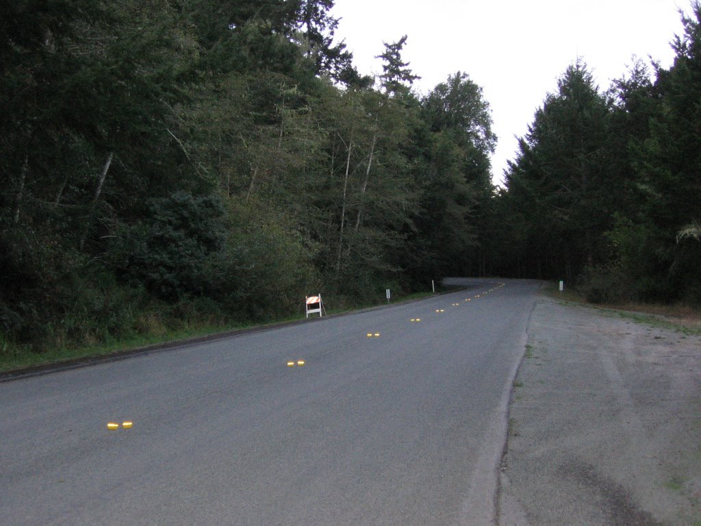
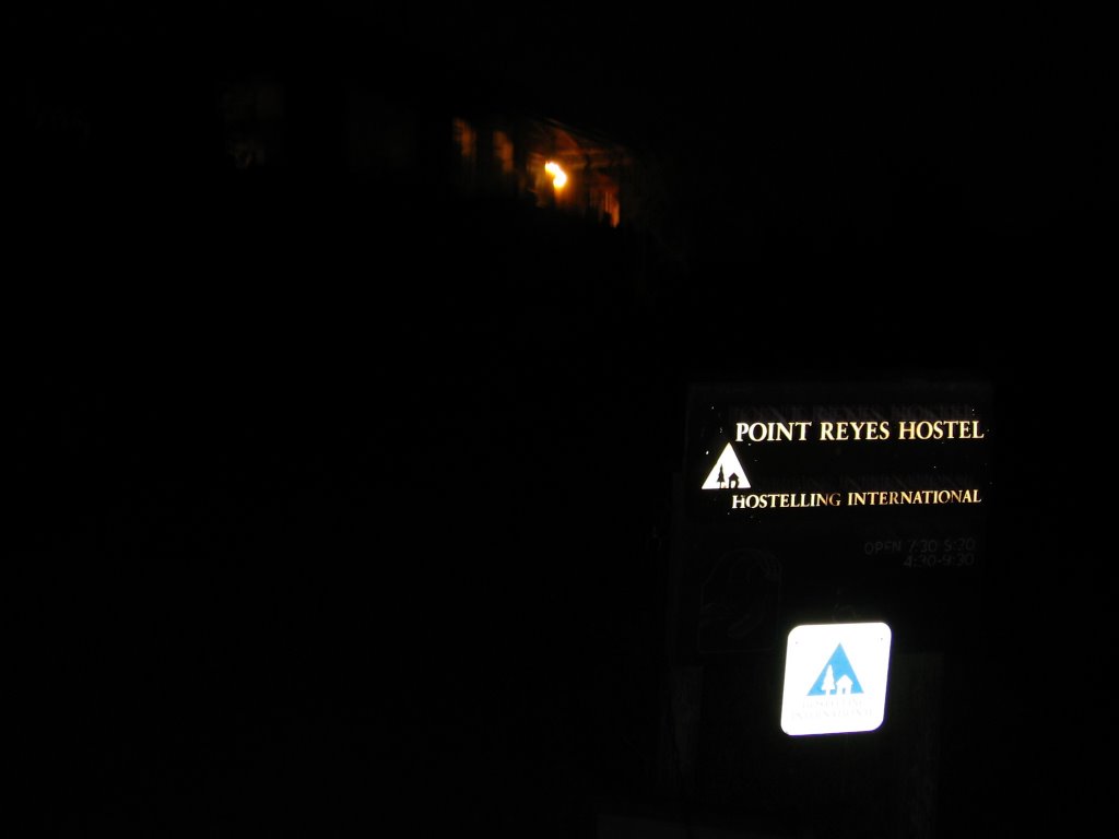
Point Reyes AYH Hostel. The windy Limantour Road leads to the hostel. It is 8 miles from Olema, 10 miles from Point Reyes Station. However, those are rather long miles as it involves climbing over two passes at 756 ft and 836 ft.
The final descent to the valley where the hostel lies, would have been sweet if not for the fact that I was descending at night. Imagine losing 500 feet of elevation on a 17% grade. I hit 42.4 mph (67.8 km/h) before reason got the better of me. The laws of physics still apply in the dark, you thunk??
The Point Reyes AYH Hostel is rather isolated. Apart from the ranger's residence by the beach, 2 miles south, there are no other homes. Just wilderness. Click
here on this satellite photo and zoom out to get an idea.
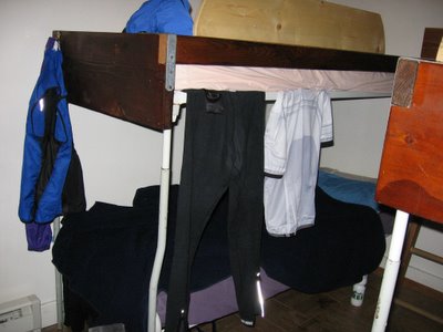
Men's dormitory. I made a bee-line for the bed beside the heater. Yeah, I know my sweaty clothes hanging to air look unsightly, but there was no one else sleeping in this dorm for the night; I had it all to myself. Lodging costs: $16. Sheets: $1. Towel: $1. Voluntary chore: 15 minutes.
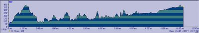
Map of today's ride.
 TOPO!
TOPO!'s elevation profile of the day's ride.
Distance cycled for the day: cyclo-computer 59 miles (94.4 km) /
TOPO! 56.66 miles (90.65 km).
Elevation climbed: altimeter 7540 ft (2271 m) /
TOPO! +
GPS 6585 ft (2001 m).
Nov 2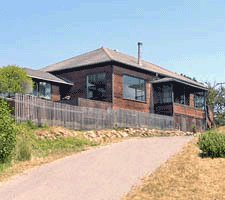
What the front of the hostel looks like.
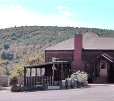
The back.
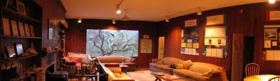
This is the common room of the hostel. There was a lot of reading material but I hardly got to any as I was busy chatting with other travelers. There was this sweet couple in their late 40s from Missouri. The husband successfully inducted his wife into the world of cycling. Since then, they have been taking their annual vacations in California and spending their time cycling around together. Sometimes, they would take turns being the shuttle driver so that the other could enjoy a long ride without having to factor in reserve energy for the return trip.
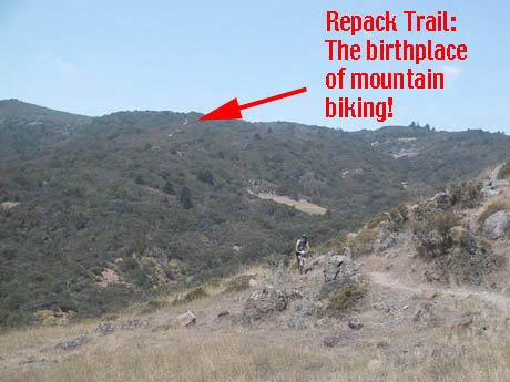
I also met and had an intimate chat with a mountain biker, Anne, who was on a solace-seeking journey after having lost her dog of 10 years. The ashes were in an urn in the back of her truck, and she intends to stand on top of a cliff and spread it over the Pacific Ocean later that day. She also brought along her mountain bike to bomb down the historic Repack trail at Pine Mountain after that.

Repack trail is a long (in those days), rutted, and steep fire road in Fairfax that got its name from the pioneers of mountain biking. Repack trail is home to the first mountain bike races. In mid-70s, crazy cyclists such as Joe Breeze, Otis Guy, Gary Fischer, Tom Ritchey, and Charles Kelly would descend this particular trail on nothing more than clunkers with large "balloon" tires and hub "coaster" brakes. By the time they get to the bottom, the braking would have generated so much heat that all the grease will have melted out of the bearings, necessitating repacking the rear hub.
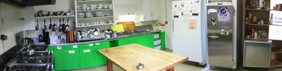
Hostel kitchen. It is fully equipped, save for a wok. *grin* All you need to do is to bring your own food. Not as if my food (instant oatmeal and freeze-dried pasta primavera) needed any significant cooking (apart from hot water).
Decided to ride the last 2 miles to Limantour Beach since I have already ridden 75% of the way there by going to the hostel. There is a 343-feet hill to climb over to reach the beach.
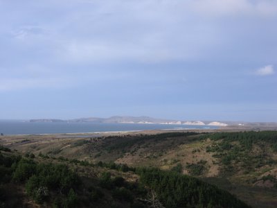
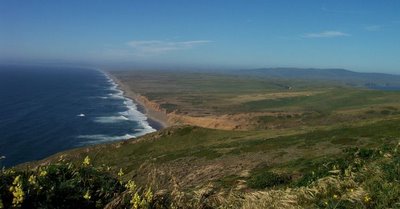
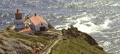
View from the top of the hill. The tip of the headlands on the left is
Chimney Rock. 4 miles east of that is the Point Reyes Lighthouse, my intended destination.

However, the only land route to Point Reyes Lighthouse from Limantour Beach or Estero de Limantour is via Limantour Road to Sir Francis Drake Boulevard.
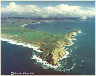
Here's an aerial photograph by Robert Campbell to serve as an illustration. The piece of land closest to the viewer is where the lighthouse is located. Chimney Rock lies on the opposite end. On the other end of the bay (out of the picture) is Limantour Beach.
Cyclist's view of Limantour Road beginning its descent towards the beach.
Driver's view.
Getting closer. Asking me where did I park, the couple in the Jaguar couldn't believe I cycled from San Francisco. *laugh*
Hey-yo, Silvaaaaaa!
Wider view.
 Limantour Beach
.
A long, narrow spit of sand, bound between Drakes Bay and an estuary, is a bountiful wildlife area. Scores of shorebirds feed in the wetlands and along the beaches during the fall. Ducks abound in winter at old, freshwater stock ponds created during the peninsula's ranching era. Harbor seals are often seen bobbing offshore in the gentle waves or basking in the sun's warmth.
Paths cross the
marsh to get to beach.
9:10 AM: time to head on back to the hostel to perform my chores (wipe down the sinks and mop the men's bathroom) and check out.

After climbing over the pass that separates Limantour Beach and hostel from the rest of Point Reyes Park, it is 19 miles (30.4 km) to the Point Reyes Lighthouse via Bear Valley Road, and then Sir Francis Drake Boulevard.
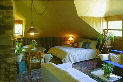
A mile later, located in
Inverness Park, is the
Abalone Inn. A charming, Victorian style bed and breakfast, I like their cozy attic suite the best (pictured above).
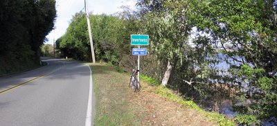
About 3 easy miles along Sir Francis Drake Boulevard later, the town limits of
Inverness. On the right is
Tomales Bay.
Looking back southwards, from left to right: Tomales Bay, Bolinas Ridge and the Three Peaks, Sir Francis Drake Boulevard. When I rode back in the evening, the entire ridge turned gold in the setting sun.

Downtown Inverness. Lots of accommodations here, starting at $130 a night. The
rooms of the
Inn on Tomales Bay have great
views.
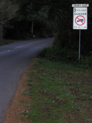
Saw this sign on Drakes View Road on the way. There is a pass in the Sierras that is 26%, and it's a public road too!
Sonora Pass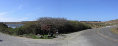
There is a 400 feet hill after Inverness, and then a gentle downhill to Johnson's Oyster Company (elevation 10 feet). The shellfish is available to drive-up customers. You can buy them in several sizes, shucked or not. On the left of the sign is Schooner Bay, which opens to Drakes Estero. It is after this 10 mile mark (approximately) that the going gets tougher.
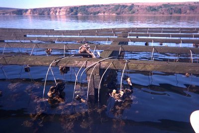
Oyster racks. The oysters are grown on vertical wires hung from racks built over the water.
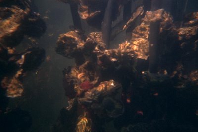
Yum! Pass the lemon wedge and Tabasco sauce!
No, that's no camera trick. That's the first of the many rollers on the road to Point Reyes Lighthouse. This one has an elevation of 230 feet. According to the map, beginning from Johnson's Oyster Company (10 feet) to the Lighthouse (500 feet), the elevations of the rollers go like this: 50, 230, 170, 320, 110, 250, 100, 380, 300, 500, 500 feet.
As vehicles pass me, some would honk in encouragement, others would roll their windows down to give the thumbs up.
Kehoe Beach.
A half-mile walk alongside a marsh and over a sand dune takes you to the northern end of the Great Beach, called Kehoe Beach. Once at the beach, turn left to explore the stream meandering its way into the Pacific Ocean. To the right, giant dunes make explorations fun. Follow the beach further north to see the dramatic juxtaposition of rocks. The first cliffs you see are the smooth Lairds sandstone, which change abruptly to granite. A reverse fault displaced the sandstone against the granite upon which it was deposited, creating a continuous cliff made of very different rock types.
Dogs allowed! Ruff! Ruff!
 North Beach
.
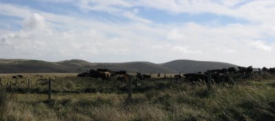
Look, Ma! Hamburger on legs! There are a number of historic ranches on Point Reyes. Some of them date as far back as 1852.

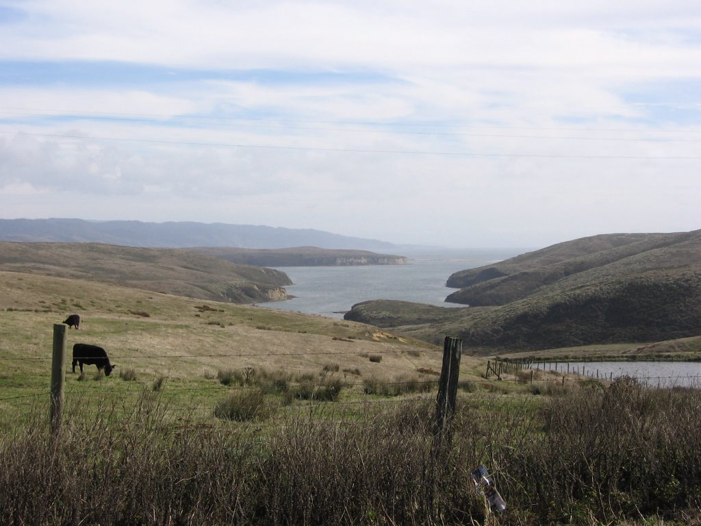
Drakes Estero.
Why Drake? And why is the road servicing the peninsular named Sir Francis Drake Boulevard?
History buffs read
this.
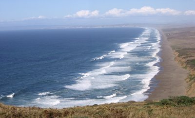
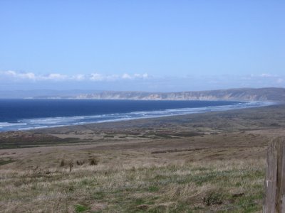
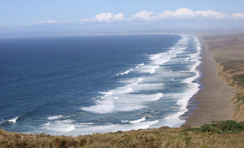
View of Point Reyes Beach (also known as "The Great Beach") from the Lighthouse footpath. The white structures denote the access area known as South Beach. To get an idea of how big the waves are, I am 500 feet (152.4 m) above the water.
There also exists a natural phenomenon known as "Sneaker Waves." From the
park safety advisory:
Visitors to Point Reyes beaches are advised to be aware of sneaker waves. A sneaker wave is an unexpectedly large wave, higher, stronger and reaching farther up the beach to levels far beyond where the normal waves reach. Beach goers, particularly children, can quickly be caught in the rip current and pulled out to deep water. If the person can not escape the current, they may drown. This has occurred numerous times at Point Reyes Beaches. Sneaker waves also have the ability to toss around large driftwood logs that may fall on a person, injuring or even killing them.
Even though the ocean may appear calm, there is still the potential for sneaker waves. Larger waves, moving fast, pick up smaller waves and carry them toward the beach. Some people erroneously think that sneaker waves can be predicted, i.e., every fourth or fifth wave, but in truth they are unpredictable. They can occur at any time, day or night, during incoming and outgoing tides, during storms and during sunny calm weather.
How to avoid sneaker waves
Never turn your back on the surf
Stay at least thirty yards away from the water on beaches facing the open ocean, particularly the Great Beach (North and South beaches), McClures Beach and Kehoe Beach. Watch out for sneaker waves. Sneaker waves are often preceded by a lower than sudden lowering of the water level. Supervise children at all times. Two children died at the South Beach after being hit by sneaker waves in 2001.
Avoid slippery rocks
Rock outcrops can be slippery from mist, rain, or spray. Large waves can knock people off rock outcrops and severely injure them or knock them unconscious. In early 2004, a person at McClures Beach was killed when she was knocked off a rock by a sneaker wave. Stay away from rocky areas, particularly during storms, high tide, or tidal changes.
Avoid logs and debris
Sneaker waves are strong enough to take the biggest log and toss it on you. Stay away from logs in surf or wet sand. Do not sit or stand on logs. Keep children away from logs and large debris.
(
Source)
I find the last part about giant waves tossing logs on people humorous in a
Tom and Jerry,
Itchy and Scratchy,
Happy Tree Friends kind of way, but maybe that's just because I have a twisted sense of humor.
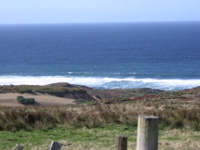
A wider perspective by
Chris Wood.
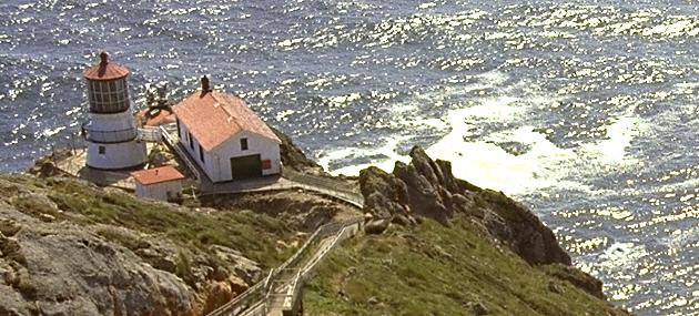
86.15 miles (137.84 km) since I started riding: Point Reyes Lighthouse Visitor Center. The rollers made me hungry — had a lunch of a
Cliff Bar here. Those "white logs" are actually the sun-bleached bones of a whale. If you look carefully, on the left of the lady is the skull of a whale.
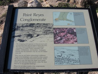
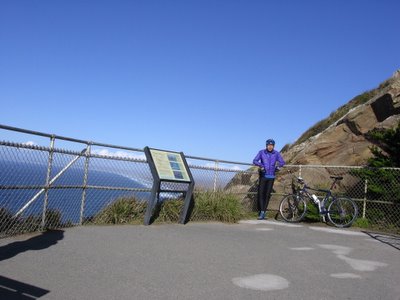
For those interested in geology. The little white box in the top picture says, "You are here." The protrusion on the right is
Chimney Rock, which was visible earlier from
Limantour Beach.
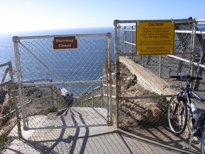
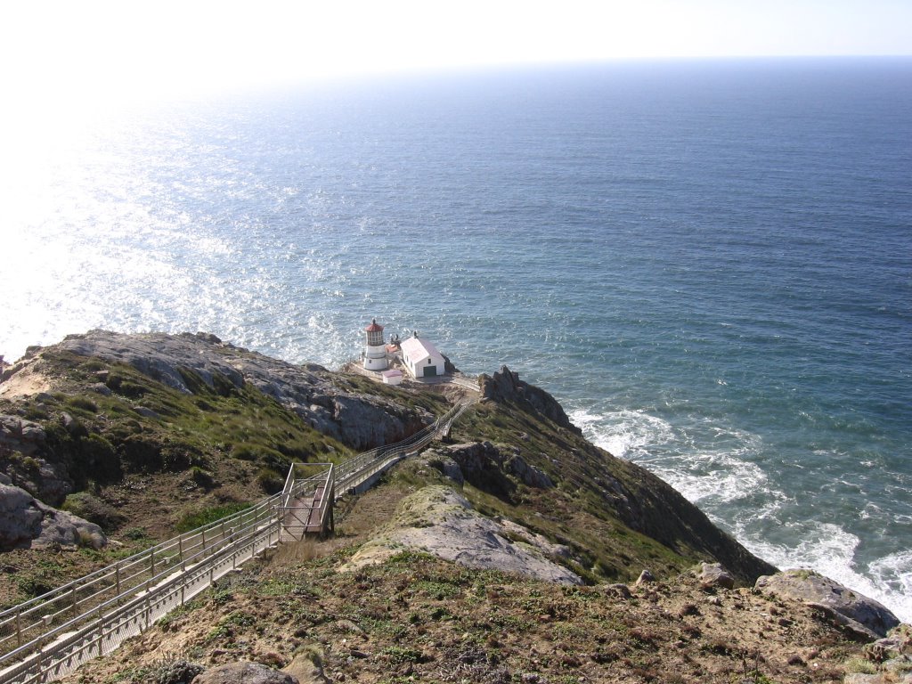
The stairway descends 300 feet to the lighthouse (elevation 200 feet), which was built in 1870.

Stairway descending to the
lighthouse. I shall bring a
Slinky next time.
From here, there's nothing but the Pacific Ocean until you reach Japan.
Moi. Picture taken using
UltraPod II.
The ride back was uneventful. The rollers meant that there were just as many uphills on the return journey. My right knee and left Achilles' tendon, despite having taken aspirin, started to bother me after 15 miles at Inverness. 21 miles from the lighthouse, I reached Olema 15 minutes before sunset, at 5 PM. I was ravenous and had a meal of a roast beef wrap, chips and a Gatorade. The clerk told me that there was a bus that goes from Olema to
San Rafael but he wasn't exactly sure as to the timing or schedule.
I was faced with 3 options: ride
southeastbound Sir Francis Drake Boulevard to the Larkspur Ferry Terminal, a journey of 21 miles and 2228 feet of climbing, in the darkness; spend the night in Olema ($$$$), Point Reyes Station ($$), 2 miles away, or Inverness ($$$), 6 miles away; or ride the bus as far is it will take me and push southwards to San Francisco to catch the 12:01 AM southbound
CalTrain. Returning to the Point Reyes AYH-Hostel wasn't an option owing to the pass I needed to climb over to get there.
Option 1 was daunting because I was tired; both my legs were increasingly sore; it was getting rather cold (45 F / 7.2 C); and perhaps most important of all, my clothing was too dark to be seen by drivers, despite my lights, and the road had no shoulder (cyclists have been run over by drivers on this road before).
Option 2 was very attractive as I longed for a hot meal, a hot shower, a bed to sleep in, and I had the budget (but not clothes) for another night's stay.
Option 3 gave me some of the benefits of the two preceding options: I get shelter from the wind and cold whilst on the bus, and I get to cycle a shorter distance back to San Francisco when I get off.
As it turned out, the convenience store clerk was wrong. The bus had already left. I stood in the cold and darkness for 2 hours waiting for a bus that never came before a couple asked me what I was doing in a dark parking lot, hopping around to keep from freezing. After they assured me that the bus had already left, I pulled out my map and started searching for the nearest motel. After seeing his wife to her seat, the gentleman got in half-way in his vehicle before changing his mind, exiting, and walking over to offer me a ride over the hills. As he strapped my bike down in the back of the truck, I thanked my lucky stars, hoped they were not axe murderers who failed to find a victim on Halloween, and jumped in.
They were such a sweet couple. I don't even know their names. He is from Christchurch, New Zealand, and she is from Melbourne, Australia. They met on a train in Sydney, both en route to a horse show. Today is their 13th wedding anniversary. They moved here to
Inverness, California 7 years ago. As the long, lonely road, meandered before us, illuminated by the truck's anemic headlights, we traded travelers' tales of wildlife seen, encountered, and heard. Think of the closing scene of
Terminator 2 and you get the idea.
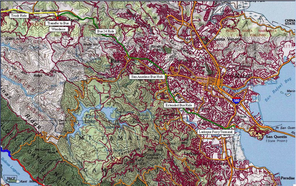
Yellow line represents the route covered via truck.
The couple's generous offer saved me 1646 ft of climbing.
After having traveled 11.23 miles, as we passed the town of
San Geronimo into
Woodacre, the couple spotted Bus No. 24 and, with a succession of honks and flashes from the headlights, signaled it to stop. Initially, the bus driver was reluctant to take me as it was not only illegal for him to pick up fares between bus stops, but bicycles aren't allowed on this service either. After some pleading from me and the New Zealander (and tales about me being eaten alive in the night by vicious raccoons and killer rabbits), he agreed, and placed my bike in the cargo compartment. After a round of gratitude, farewells and congratulations on the couple's 13th anniversary, I took my seat on the bus, beside my next samaritan.

Red star marks the transfer from the truck to the bus. Green line to the yellow diamond (bus hub / depot) is the official bus route. Beyond that was done as a voluntary favor by the bus driver (I didn't ask).
The "extended" bus ride saved me 10.06 miles and 582 ft of climbing.
Fare: $4. I was the only passenger on board. As the bus descended eastwards into the night, the bus driver and I chatted about cycling (it turned out that he was a cyclist too). In a spirit of generosity, even though the line officially ends in
San Anselmo, he offered to drive me another 5 miles to the Larkspur Ferry Terminal. I must have had a guardian angel looking over me that night. With gratitude, I begged him to accept a small token of my deep appreciation (which made him very happy as he said it would mean dining out for his family tonight), and crossed the parking lot to the ferry terminal.
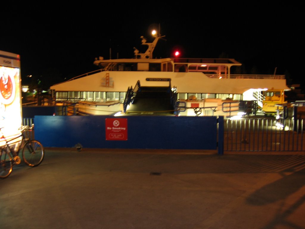
Reached the
Larkspur Ferry Terminal at 8 PM. Just in time for the 8:10 PM ferry.

The ferry Mendocino. Waiting for the gate to open. Fare: $6.45
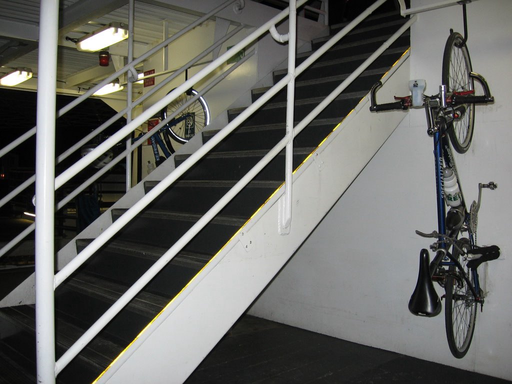
 Ivy
Ivy (that's the name of my bike), on the ferry's bike rack.
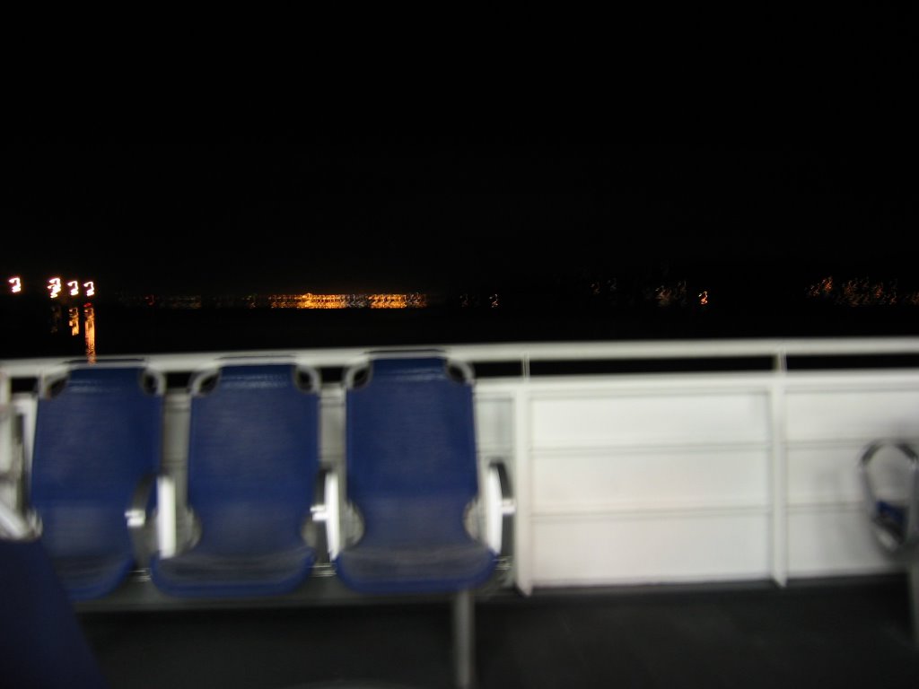
Leaving the city of
Larkspur. Next stop, San Francisco.
Purple line (on the right) denotes the 13 mile Larkspur Ferry route to San Francisco. Blue line marks the 1.7 mile ride from the San Francisco Ferry Terminal to the 4th and King San Francisco
CalTrain station.
 Port of San Francisco
, Embarcadero. Time: 8:45 PM. The
CalTrain Station is a 10 minute 1.7 mile pavement ride away.
Took the 10:00 PM southbound
CalTrain.
Arrived home in
Santa Clara at 11:42 PM.
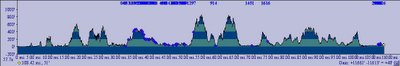
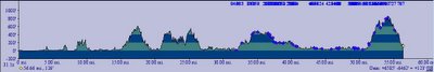
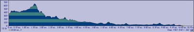
Elevation profiles for two days of riding (truck, bus, ferry rides and ride back to
CalTrain station not included).
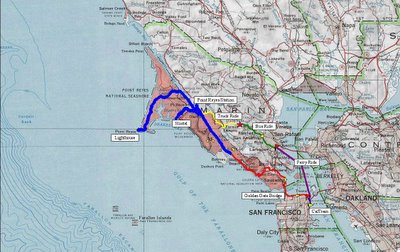
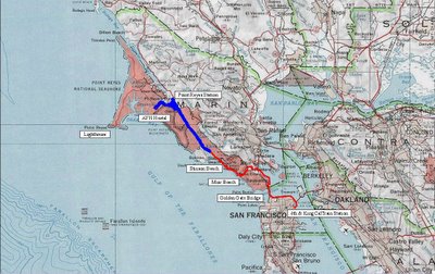
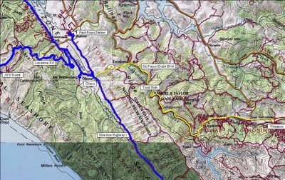
Map overview of San Francisco-to-Point Reyes Lighthouse ride.
Epilogue:
Total distance: cyclo-computer 115.3 miles (184 km) /
GPS ran out of batteries /
TOPO! 114.52 miles (182.23 km).
Total elevation climbed: Altimeter 11,230 ft (3423.78 m) /
GPS +
TOPO! 11,661 ft (3555.18 m).
Temperature range: 68 F to 44 F (20 C to 7.2 C).
Fluids consumed: 12 liters.
This ride was conducted solo.

 Specialized HQ, 15130 Concord Circle, Morgan Hill, CA 95037.
 Reception area. Ned "The Lung" Overend (how many of you kids know who he is?) is on one of the posters.
 Lobby area.
 Another shot of the lobby area. It looked as though there were bikes of every year's model in there.
 Specialized parking lot.
 Instead of a solid white line, they have...
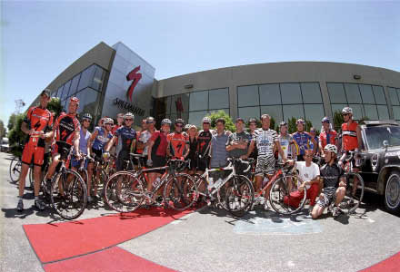 File picture.


