Haven't ridden all week and needed a "maintenance ride," and so I decided to return to Black Mountain nearby for a fun workout.
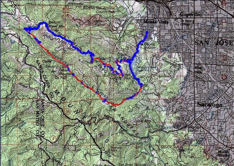 Route highlighted in red. GPS track points in blue. As it can be observed, the GPS unit had a difficult time getting a fix in the canyon.
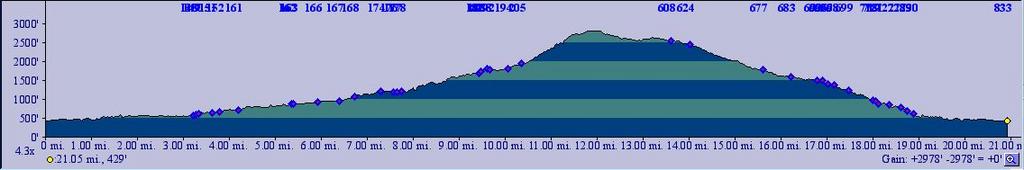 TOPO!'s elevation profile of the route.
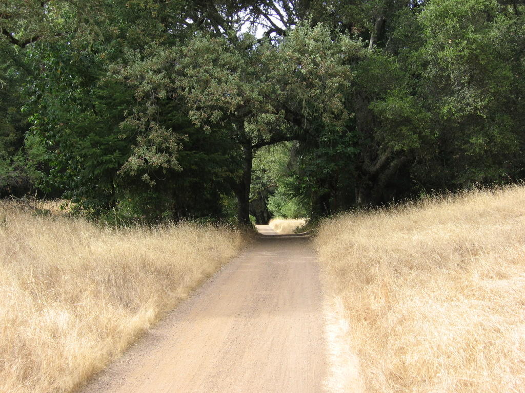
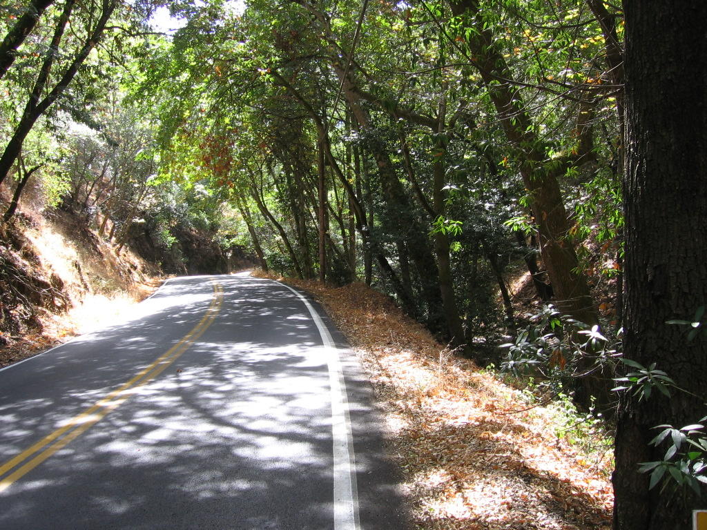 Stevens Creek Canyon Rd, a gorgeous, shady road that rises 659 feet over 5.54 miles to the Stevens Canyon trailhead.
 Stevens Canyon trailhead. Watched a rider jump this. According to him, clearing the logs is only part of it. After you land (successfully), you have to jam your rear brake, and make a hard left to follow the trail so as not to smack into the trees immediately ahead.
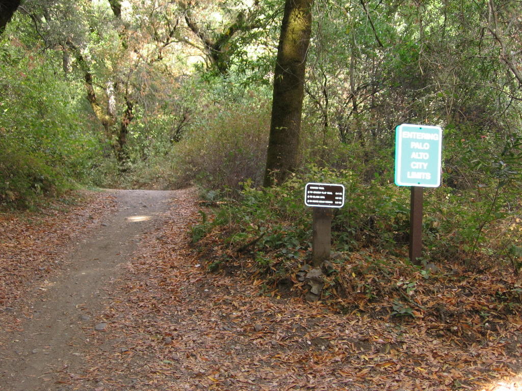 The green sign amused me: it is so incongruous that a sign like, "Entering Palo Alto City Limits," is planted deep in a forested canyon.
Half-way through the climb, I ran into a horde of black flies with bad tempers. You see, most flies just buzz around your head and irritate the heck out of you. But, on the downhills, you lose them. Well, these flies are different. They would buzz around my head, ears, neck, mouth, nose, and even get behind my shades to my eyes. And when I get on the downhills, they will fly to the rear of my helmet and hide in the air channels. Sometimes they get wedged between my head and the helmet. Then, they will get pissed and bite me. I have like 30 bites on the back of my scalp. And they are unbearably itchy.
Finally lost them when I reached the summit and I took off my helmet though. Guess they just couldn't keep up with the constant wind gusts.
Thought I had it bad until I read this post on a thread, "You know those little holes in your helmet?":
I had a wasp fly in once. Focker hit me 5 times before I got the helmet off. I musta looked like I lost my mind, flailing away at my own head like that... -- RobW
 Stevens Canyon trail goes from forested singletrack to a fire road that winds in and out of forested sections and open meadows.
 A wider perspective.
 Stevens Canyon trail ends and becomes Indian Creek trail, a fire road which climbs about 850 ft relentlessly to the summit. Here, I'm looking down.
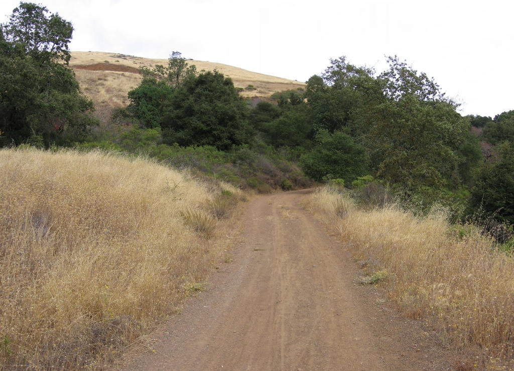 What lies ahead.
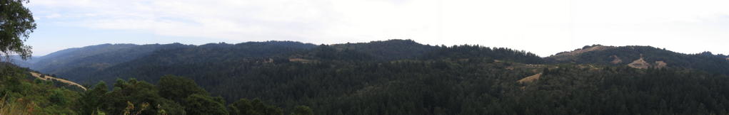 Panorama from Indian Creek trail. Current elevation 2065 ft. Stevens Canyon trail runs along the forested section on the left. The canyon is a product of the San Andreas fault, and, in certain sections, the trail actually runs on top of it! Skyline Boulevard / Highway 35, a twisty road popular with sportbikes and automobile enthusiasts, lies on the ridge across the canyon.
 Altitude 2400 ft. Just about 410 ft more to the summit. Looking down here.
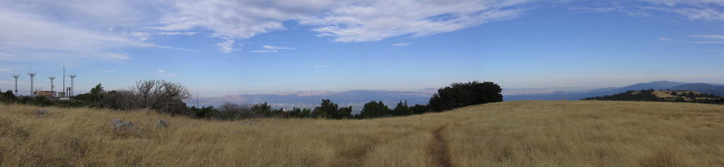 View from the summit, eastwards. Silicon Valley and the Diablo mountain range, with Mount Hamilton immediately on the left of the tree in the center.
 A closer view. On the left, part of the bay, and the city of Milpitas. Mount Hamilton on the left of the tree in the center.
 The summit of Black Mountain, elevation 2810 ft (857 m).
 USGS marker.
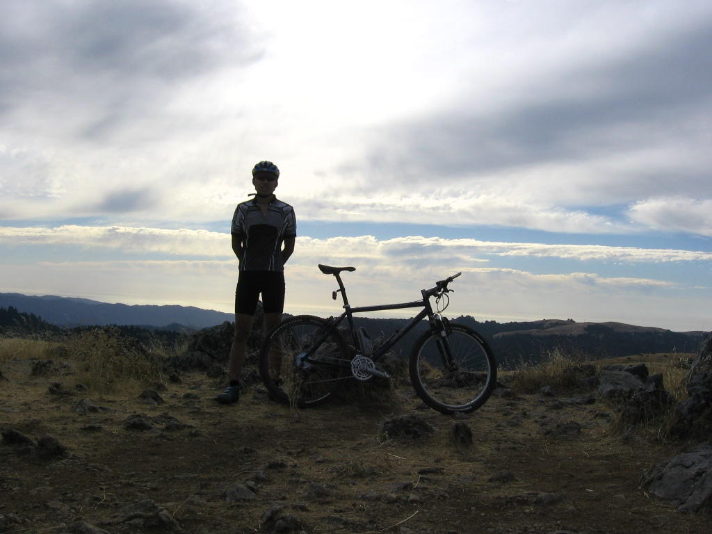 Moi.
Moi. Looks like I'm wearing stockings, doesn't it?
Descending 5.11 miles of Montebello Road took under 10 minutes as I lost 1987 ft in elevation.
Epilogue:
Total distance: Cyclo-computer 19.9 miles (31.84 km) / GPS 20.76 miles (33.22 km) / TOPO! 21.05 miles (33.68 km).
Total elevation climbed: Altimeter 3080 ft (939 m) / GPS + TOPO! 2978 ft (908 m).
Temperature range: 62 F to 68 F (16.7 C to 20 C).
Fluids consumed: 1.5 liters.

No comments:
Post a Comment